ShopDreamUp AI ArtDreamUp
Deviation Actions


Suggested Deviants


Suggested Collections


You Might Like…


Featured in Groups


Description
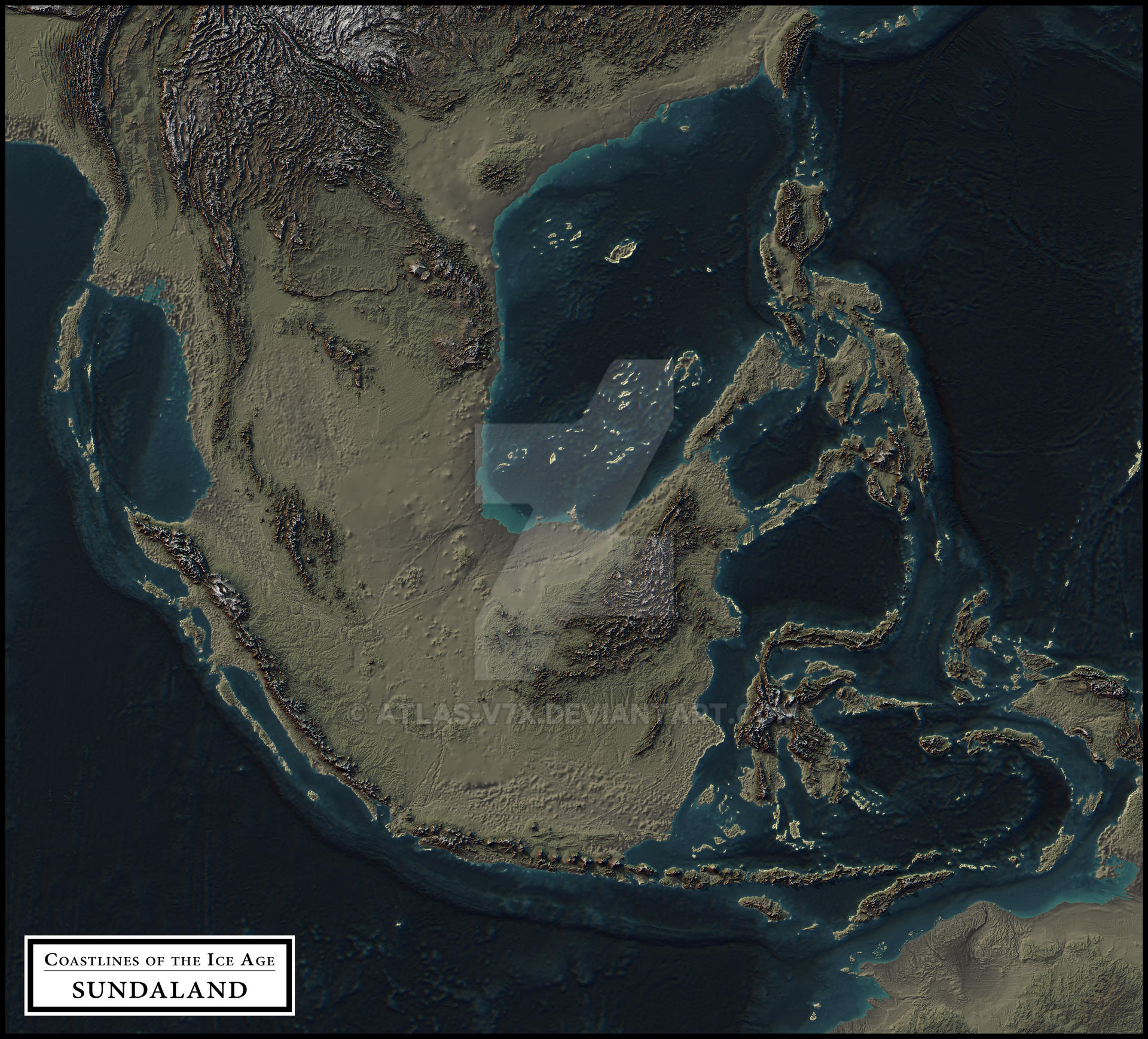
This map shows how the terrain may have appeared during the Last Glacial Maximum, around 21,000 years ago, when sea levels were approximately 125 meters (410 feet) below present. This map does not include any lakes of this time period. The colouring of the map is based on height, and is not meant to represent the climate or vegetation in any way. You can find the elevation key as a separate image here. This map also does not account for any geological or tectonic changes in the landscape since this time period, as the map was made using a modern terrain map with a lowered sea level to simulate an approximate representation of the ice age coastlines.
Image size
5260x4754px 6.95 MB
© 2017 - 2024 atlas-v7x
Comments6
Join the community to add your comment. Already a deviant? Log In
I need a high resolution map of the eastern cluster of islands (presently Andaman and Nicobar Islands) for my research. Could you kindly correspond with me at sayantaniiser@gmail.com to discuss the possibility?